U.S. Global Hawk Drone Conducts Rare Long-Range NATO Patrol from Mediterranean to High North
{loadposition bannertop}
{loadposition sidebarpub}
A U.S. Air Force RQ-4B Global Hawk from NAS Sigonella flew a rare long-range patrol on November 11, 2025, covering the Mediterranean, Eastern Europe, and Arctic approaches. The mission tightened NATO’s surveillance web across multiple theaters, reinforcing deterrence and intelligence continuity near allied borders.
On 11 November 2025, a United States Air Force RQ-4B Global Hawk operating from NAS Sigonella executed an extended north–south intelligence patrol spanning the Mediterranean, Eastern Europe, and the High North. The flight pattern, visible to open-source trackers, connected established surveillance corridors from the Black Sea to the Barents without infringing restricted airspace, reflecting alliance demand for uninterrupted situational awareness. This patrol is relevant because it consolidates multiple theaters into one enduring collection window, informing air and missile defenses, reinforcement routes, and maritime monitoring. The mission was observed in real time as seen on Flightradar24 and published by X-user @PierreDavideB.
Follow Army Recognition on Google News at this link
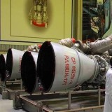
The RQ-4B Global Hawk is a high-altitude, long-endurance surveillance drone capable of flying over 30 hours and covering thousands of miles while delivering near-real-time intelligence across vast régions (Picture Source: U.S. Air Force)
Departing Catania over the Ionian, the aircraft threaded routine reconnaissance lanes past Greece and the Black Sea approaches before turning north through Eastern Europe, surveying standoff sectors near Romania, Poland, and the Baltic region. It continued along Russia’s western periphery to northern Finland and the Barents Sea approaches, then retraced a southbound arc, all while remaining outside Russian and Belarusian airspace. This geometry maximizes line-of-sight coverage across multiple fronts and compresses the time between detection and reporting by maintaining persistent eyes on the same axes throughout the sortie.
The RQ-4B’s design enables this breadth of coverage. Cruising above 16,000 meters for well over 30 hours, the platform blends electro-optical and infrared imaging with synthetic aperture radar modes and passive signals collection to fuse ELINT, SIGINT, and IMINT in a single pass. The B-model’s evolution emphasized modular payloads and open architectures, allowing sensor refresh without redesigning the airframe, while satellite-enabled command-and-control and robust automation sustain endurance and reduce the need for aerial refueling or crew rotations. In practice, this converts one aircraft into a theater-spanning collector that feeds multiple commands simultaneously.
Operationally, the Global Hawk has matured from discrete target imaging into a trend-analysis instrument. Over successive patrols, it catalogs radar behavior around Kaliningrad, profiles logistics activity along the Belarus-Ukraine interface, tracks maritime patterns in the Black Sea, and monitors Northern Fleet rhythms in the Arctic. When paired with allied airborne early warning such as NATO’s E-3A Sentry, the division of labor is clear: AWACS manages the real-time air picture and control, while the RQ-4B provides deep-look reconnaissance and long-dwell mapping for planners, intelligence centers, and air defense networks.
Strategically, stitching the Mediterranean, Eastern European, and Arctic sectors into one patrol acknowledges that these theaters are interconnected. Geopolitically, it signals allied resolve to surveil the full breadth of Russia’s western military districts within a single operational tapestry. Geostrategically, cross-cueing between southern naval movements, central European ground activity, and northern aerospace operations shortens decision cycles for deterrence and reinforcement. Militarily, the dense sensing improves target development, electronic order of battle updates, and corridor planning through Poland and Romania, while preserving diplomatic space by collecting from international airspace.
The RQ-4B profile underscores how Europe’s security architecture now relies on persistent, high-altitude reconnaissance that can knit disparate fronts into a living picture. From Sigonella to the Barents and back, the RQ-4B turns endurance into continuity, converting hours in the air into timely, actionable intelligence across the alliance’s most contested approaches.
Written by Teoman S. Nicanci – Defense Analyst, Army Recognition Group
Teoman S. Nicanci holds degrees in Political Science, Comparative and International Politics, and International Relations and Diplomacy from leading Belgian universities, with research focused on Russian strategic behavior, defense technology, and modern warfare. He is a defense analyst at Army Recognition, specializing in the global defense industry, military armament, and emerging defense technologies.

{loadposition bannertop}
{loadposition sidebarpub}
A U.S. Air Force RQ-4B Global Hawk from NAS Sigonella flew a rare long-range patrol on November 11, 2025, covering the Mediterranean, Eastern Europe, and Arctic approaches. The mission tightened NATO’s surveillance web across multiple theaters, reinforcing deterrence and intelligence continuity near allied borders.
On 11 November 2025, a United States Air Force RQ-4B Global Hawk operating from NAS Sigonella executed an extended north–south intelligence patrol spanning the Mediterranean, Eastern Europe, and the High North. The flight pattern, visible to open-source trackers, connected established surveillance corridors from the Black Sea to the Barents without infringing restricted airspace, reflecting alliance demand for uninterrupted situational awareness. This patrol is relevant because it consolidates multiple theaters into one enduring collection window, informing air and missile defenses, reinforcement routes, and maritime monitoring. The mission was observed in real time as seen on Flightradar24 and published by X-user @PierreDavideB.
The RQ-4B Global Hawk is a high-altitude, long-endurance surveillance drone capable of flying over 30 hours and covering thousands of miles while delivering near-real-time intelligence across vast régions (Picture Source: U.S. Air Force)
Departing Catania over the Ionian, the aircraft threaded routine reconnaissance lanes past Greece and the Black Sea approaches before turning north through Eastern Europe, surveying standoff sectors near Romania, Poland, and the Baltic region. It continued along Russia’s western periphery to northern Finland and the Barents Sea approaches, then retraced a southbound arc, all while remaining outside Russian and Belarusian airspace. This geometry maximizes line-of-sight coverage across multiple fronts and compresses the time between detection and reporting by maintaining persistent eyes on the same axes throughout the sortie.
The RQ-4B’s design enables this breadth of coverage. Cruising above 16,000 meters for well over 30 hours, the platform blends electro-optical and infrared imaging with synthetic aperture radar modes and passive signals collection to fuse ELINT, SIGINT, and IMINT in a single pass. The B-model’s evolution emphasized modular payloads and open architectures, allowing sensor refresh without redesigning the airframe, while satellite-enabled command-and-control and robust automation sustain endurance and reduce the need for aerial refueling or crew rotations. In practice, this converts one aircraft into a theater-spanning collector that feeds multiple commands simultaneously.
Operationally, the Global Hawk has matured from discrete target imaging into a trend-analysis instrument. Over successive patrols, it catalogs radar behavior around Kaliningrad, profiles logistics activity along the Belarus-Ukraine interface, tracks maritime patterns in the Black Sea, and monitors Northern Fleet rhythms in the Arctic. When paired with allied airborne early warning such as NATO’s E-3A Sentry, the division of labor is clear: AWACS manages the real-time air picture and control, while the RQ-4B provides deep-look reconnaissance and long-dwell mapping for planners, intelligence centers, and air defense networks.
Strategically, stitching the Mediterranean, Eastern European, and Arctic sectors into one patrol acknowledges that these theaters are interconnected. Geopolitically, it signals allied resolve to surveil the full breadth of Russia’s western military districts within a single operational tapestry. Geostrategically, cross-cueing between southern naval movements, central European ground activity, and northern aerospace operations shortens decision cycles for deterrence and reinforcement. Militarily, the dense sensing improves target development, electronic order of battle updates, and corridor planning through Poland and Romania, while preserving diplomatic space by collecting from international airspace.
The RQ-4B profile underscores how Europe’s security architecture now relies on persistent, high-altitude reconnaissance that can knit disparate fronts into a living picture. From Sigonella to the Barents and back, the RQ-4B turns endurance into continuity, converting hours in the air into timely, actionable intelligence across the alliance’s most contested approaches.
Written by Teoman S. Nicanci – Defense Analyst, Army Recognition Group
Teoman S. Nicanci holds degrees in Political Science, Comparative and International Politics, and International Relations and Diplomacy from leading Belgian universities, with research focused on Russian strategic behavior, defense technology, and modern warfare. He is a defense analyst at Army Recognition, specializing in the global defense industry, military armament, and emerging defense technologies.